|
|
|
|
2018年09月21日
カテゴリ:災害
Update
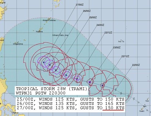
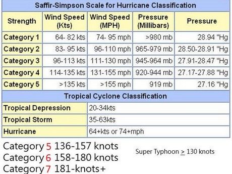
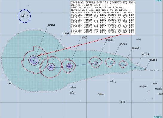
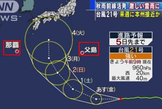
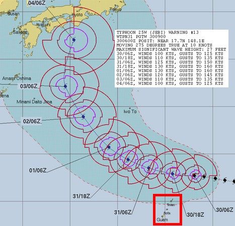
24号登場だが、 またしてもCAT5クラス、 で、気になったのは、前回台風22号もグアムを通過、 しかも、通過時に一気に勢力を上げている、 グアムって、台風の中継地? 参考)
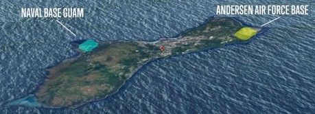
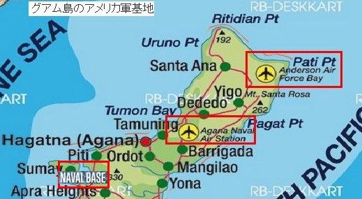
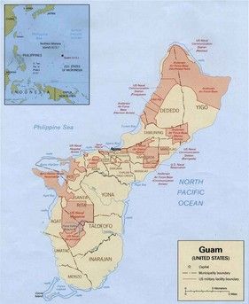
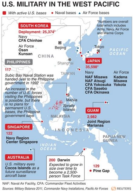
グアム島のアメリカ軍基地の拡張が、地元住民の生活と環境を脅かしています。カナダのインターネットサイト、グロ-バルリサーチによりますと、グアム島の住民は、真の脅威は北朝鮮ではなくアメリカであると。 レーダー施設、(赤いエリアで島の半分は米軍!?)
拡大すると、
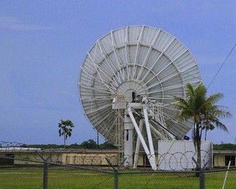
*サンプル:アンダーソン空軍基地内のレーダー、
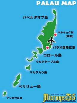
強力ソーやな、 参考2) 昨年夏のパラオと米国ペンタゴンとの合意、 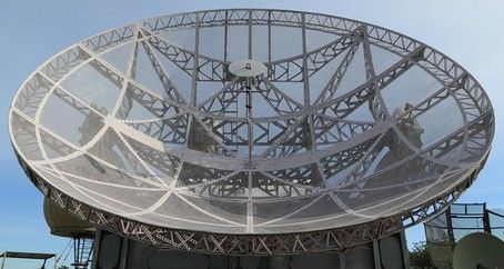 https://sputniknews.com/asia/201708241056766677-us-palau-radar-system-korea/ 2017/8/24 The Pentagon and Palau, a nation of more than 500 islands and islets in Oceania, have mutually agreed to install a radar system to help the US monitor the local air domain while respecting the integrity of the National Marine Sanctuary in Koror, Palau.
The island nation is approximately 1,300 kilometers southwest of Guam,a US territory that the Democratic People’s Republic of Korea recently threatened to strike with intercontinental ballistic missiles. パラオと言えば、
ペリリュー島で有名なのだが、 HAARPで海水を暖め、熱低を作り、 太平洋の台風なら、私たちにお任せ下さいと、 参考3)
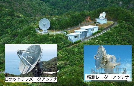
父島の宇宙レーダー2基、グアム基地レーダー群なら、 参考4) 気象操作の視点から、グアムのポジションは大きい、 が、詳細(A Map Of All Us Military Bases)を見ると、  http://ditgestion.co/a-map-of-all-us-military-bases-japan-map-us-navy-bases-us-military-bases-okinawa1/a-map-of-all-us-military-bases-japan-map-us-navy-bases-us-military-bases-okinawa1-valid-us-naval-bases-in-japan-map-military-bases-in-okinawa-valid-pacific/ 拡大して、
グアムのみならず、小さな島々にも展開されている、
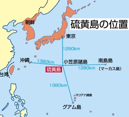
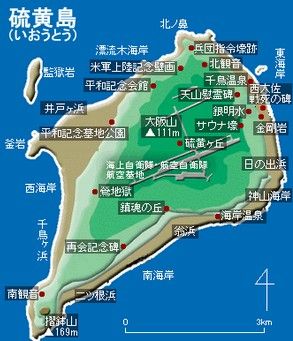
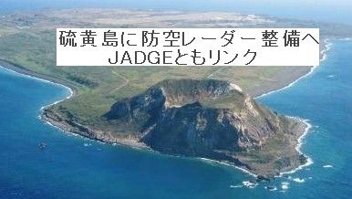
硫黄島はその位置から、激戦となった箇所、 現在は海上自衛隊の管轄だが、マッ、実質米軍だろーな、 硫黄島 現在の防空レーダーから、全方位ドーム型へアップグレード、
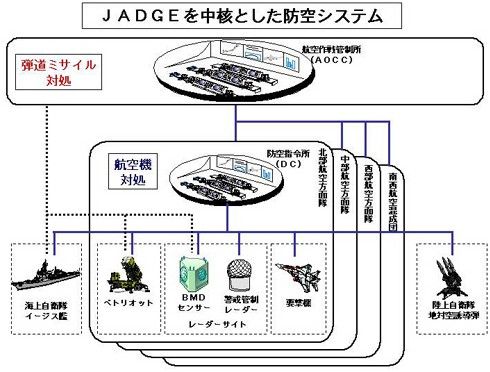
2020年から、全国レーダー網JADGEに入る、
オレ的には、JADGEって、 更新日 2018年09月22日 13時37分00秒 お気に入りの記事を「いいね!」で応援しよう
最終更新日
2018年09月23日 13時13分17秒
コメント(0) | コメントを書く
[災害] カテゴリの最新記事
|